Into the Temperate Rainforest, Land of Large Woody Debris
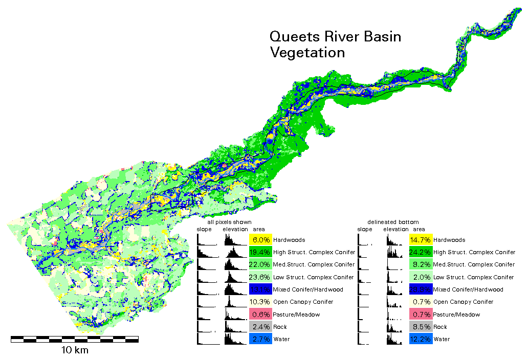
This is Matt Clark's vegetation data.
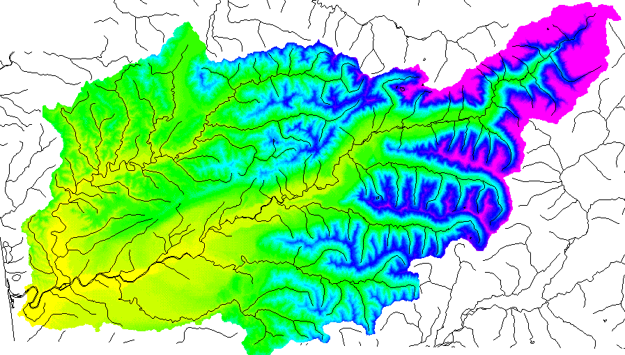
The image below shows the elevations of the Queets Basin. The rivers are from the USGS
1:100,000 series DLG files. Note that the calculated basin boundary differs slightly from the
actual boundary south of the mouth.
On second thought, let's forgot the Clearwater River tributary, and use a
"mouth" further upstream. Now let's calculate the amount of steady-state
rainfall necessary for soil saturation and for
soil instability
We also have additional information for
the Matheny Creek tributary.
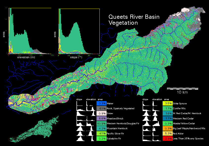
Vegetation type, from TM satellite imagery, with
hemlock/Doug fir echoed in corner inset.
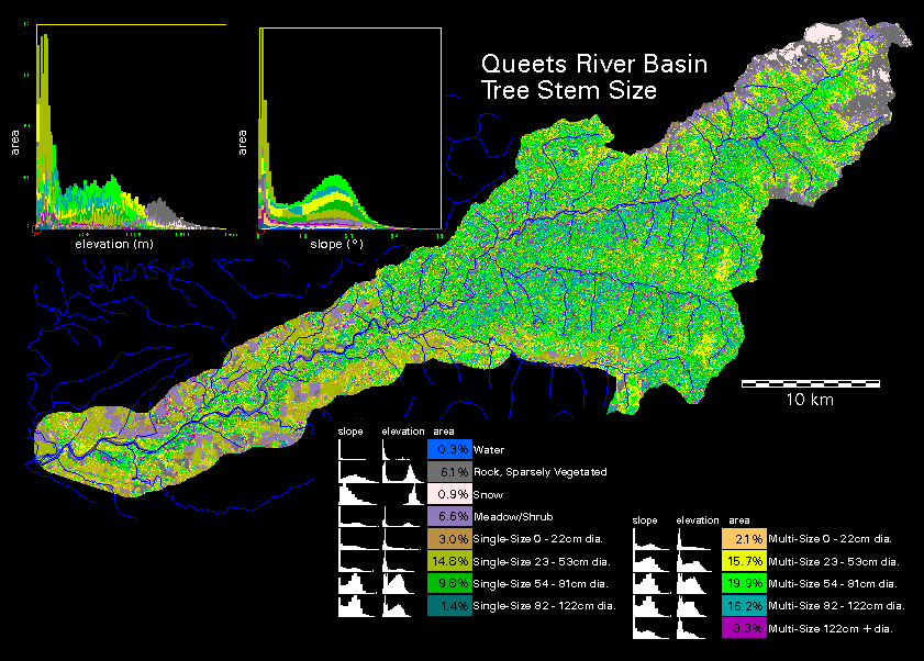
Tree trunk size, from TM satellite imagery
thesis.tiff queets map
thesis_b.tiff regional basemap
Process Domain Images