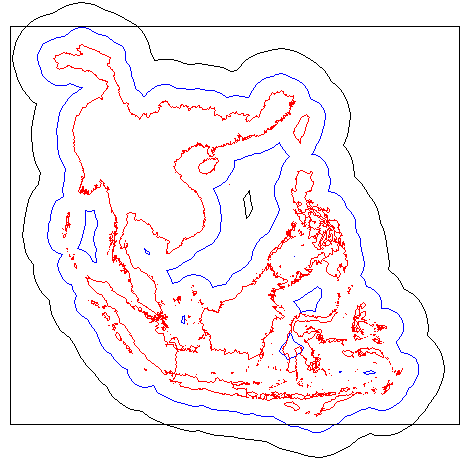
This shows our study basins, the 2° buffer used for selecting weather stations, and the 5° used for selecting radiosonde stations. The rectangle indicates the size of the data grids being passed on the the VIC model.

This shows our study basins, the 2° buffer used for
selecting weather stations, and the 5° used for selecting radiosonde stations.
The rectangle indicates the size of the data grids being passed on the the VIC
model.
For January ,1997 through September, 2000, we downloaded the daily records from the
National Climatic Data Center
1254 stations fall within 2 degrees of our study area. The number of stations with
data on any given day is:
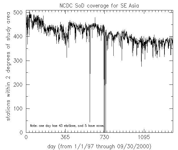
(This graph is actually the count of valid temperature
stations; the number of wind and rainfall stations varies slightly.)
The initial phase of our processing is done in geographic coordinates.
This gives a bias to the weights of stations to the east or west of a point,
but the effect is small at these latitudes. Subsequent calculations involving
areas all use corrected values.
Max temperature, min temperature, wind, and precip, were extracted from the NCDC
ASCII files and placed in 1368 daily files. These files were converted to
ARC/INFO "coverage" format. For the five missing days, grids were created by
temporal interpolation.
Quarter-degree grids of wind speed were created for each day by using an inverse-distance-weighted algorithm built into ARC/INFO. The algorithm averages all stations within 0.18 degrees of the grid center, but extending the search until at least 4 stations are found.
Precipitation grids were made in a similar manner, but with less confidence. We judged the NCDC GPCP (Gloabal Precipitation Climatology Project) one-degree rainfall to be superior to any product we could devise, so we created our grids only for comparison.
zcat 3B42.990101.5.HDF.Z | cutout 320 54 48 112 85414 4 90 > 990101
OR
foreach month (01 02 03 04 05 06 07 08 09 10 11 12)
  foreach fil (3B42.??${month}*)
    zcat $fil | cutout 320 54 48 112 85414 4 90 > `echo $fil | cut -d '.' -f2`
  end
end
Comparing 990101 to the NCDC 1dd data (after multiplying by 25.4), the mean
difference is 0.22 mm, with a with abs(diff) of 3.33 mm, while all rainfall
patterns are maintained.
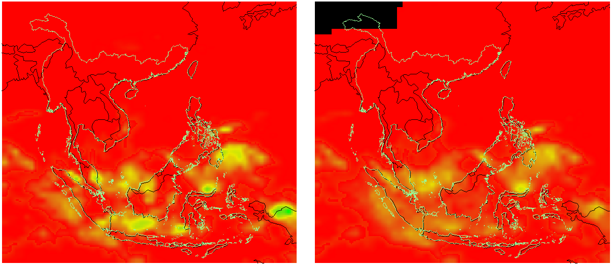
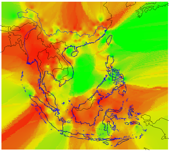
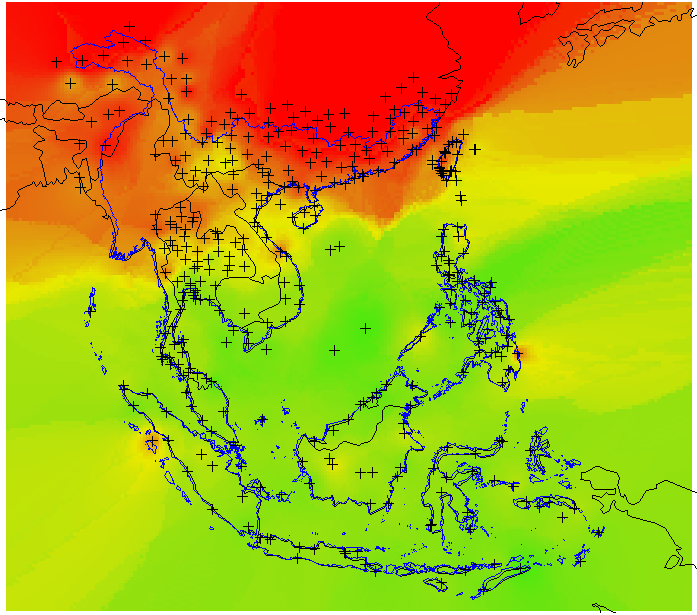
Here is the wind interpolated from station data for that day.
This is minimum temperature, adjusted to sea level and interpolated.
Weather stations with wind data are shown.
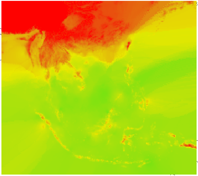
and this is the same data, adjusted back to surface elevation.
Here are graphs of the datasets.
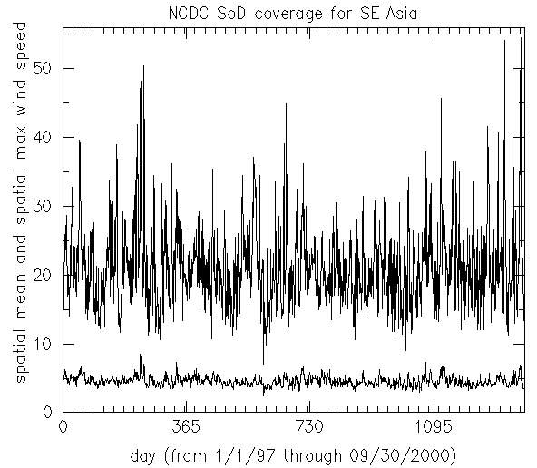
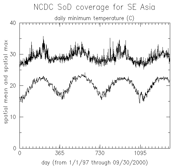
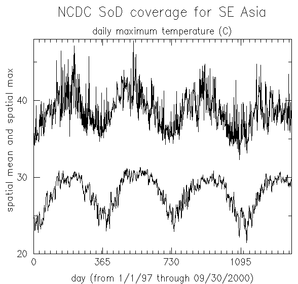
These graphs represent unmasked rectangles. The data points were selected
near our study basins, so there are some severe extrapolations in areas
which will be masked out in the VIC model.
DOWNLOAD NCDC GPCP rain data 1/97-11/99, including 1/10/98 fix
DOWNLOAD replacement NCDC GPCP rain data for Jan 10, 1998(see note below)
DOWNLOAD clipped TRMM data
DOWNLOAD wind data interpolated from stations.
DOWNLOAD minimum surface temperature interpolated from stations. (based on constant lapse rate)
DOWNLOAD maximum surface temperature interpolated from stations. (based on constant lapse rate)
 DOWNLOAD new NCDC GPCP rain data 11/99 - 12/2000
A comparison of this November 1999 with the previous one shows that NCDC
made minor updates to their files. The file names in this dataset differ from
the old ones in having 4-digit years.

 DOWNLOAD new TRMM rain data 10/2000 - 03/2001


 DOWNLOAD newer TRMM rain data 4/2001 - July 4,2001
DOWNLOAD still newer TRMM rain data July 1,2001 - November 30,2001
Note: There were only 43 weather stations for January 10, 1998. Therefore, temporal interpolations of temperature data were used. The NCDC GPCP rainfall record for that date looks plausible enough (It is, afterall, a synthesis of satellite and ground data.), but it happens to be be the only daily rainfall record for which the maximum is less than 25.6 mm. This caused problems with the export routine, which wrote an 8-bit file instead of a 16-bit file. Two different fixed files are contained in gpcp_jan10.zip. The file 980110.bil has a cell with rain=25.6mm tweaked into the northeast corner, forcing our ARC/INFO software to write it as a 16-bit file. An alternative version (980110b.bil) is the average of Jan09 and Jan11.
Questions:
Harvey Greenberg