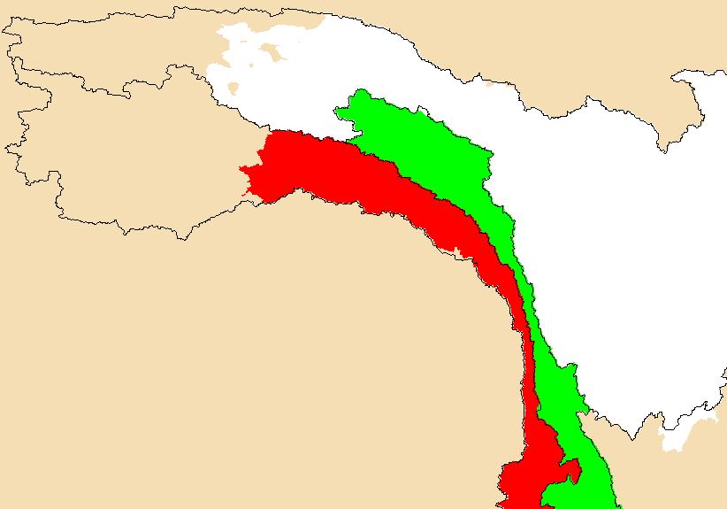
We are looking at the Three Rivers area, where the the Salween, Mekong,
and Yangzte are mashed into narrow gorges by the force of India careening
into Asia. The black lines show the basin boundaries as calculated from
earlier (lost in the mists of time, this might have been my doing.) work.
The basins were calculated by the boring old standard method: fill the
sinks, calculate flowdirection, build basins. However, an examination of
the DCW dnnet river maps shows that the upper parts of the basins lie in
undrained parts of the Tibetan Plateau. Water drains to the low spots
and evaporates. To process the SRTM DEM
properly, I punched no-data holes into the DEM at the location of undrained
lakes seen on the DCW river map, then I filled the DEM. The result is a
much smaller basin for the Salween (red) and Yangtze (white) basins.
The Mekong (green) is unchanged.
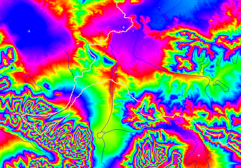
Wait, further examination of the apparent DCW sinks laid on the (now I have version2) SRTM 3" DEM show that some DCW features have no realtionship to the topography. The DCW-based sinks ought to be revised with the help of a map of SRTM sinks. The image below shows the version2 SRTM DEM with nulls filled. The colors wrap every 256 meters. DCW drainage features are blue, my introduced sinks are white crosses, and the calculated Salween basin boundary is a thick tan line.
This is a Mekong profile from May, 2005. It is based on the provisional SRTM 3" DEM, as filled by Harvey's algorithms with a combination of 30" data and interpolation. Proffix2.aml created the profile and profilesmooth_deg2m.py smoothed it. The field are 1) downstream distance (meters), 2) fixed elevation 3) tanslope 4) distance (degrees) 5) contib area (cells) 6) longitude 7) latitude 8) flag (1&2 are sinks) 9) obsolete. Perhaps we will soon compare it to a profile done on the new DEM.
Questions: Harvey Greenberg