
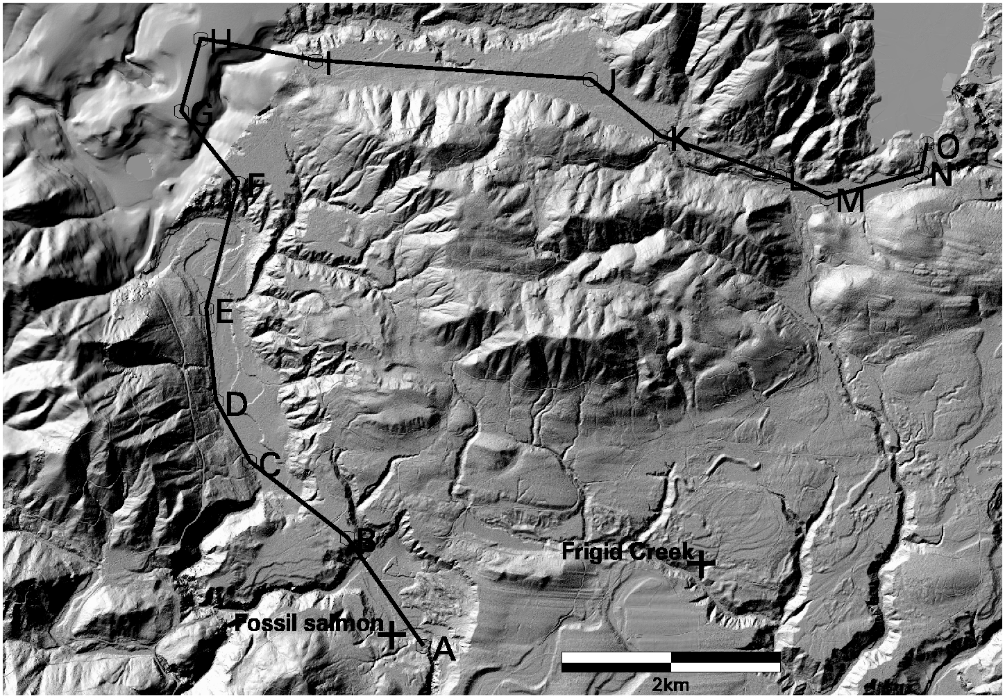
geo2006.tif geology map.
profilemap.png
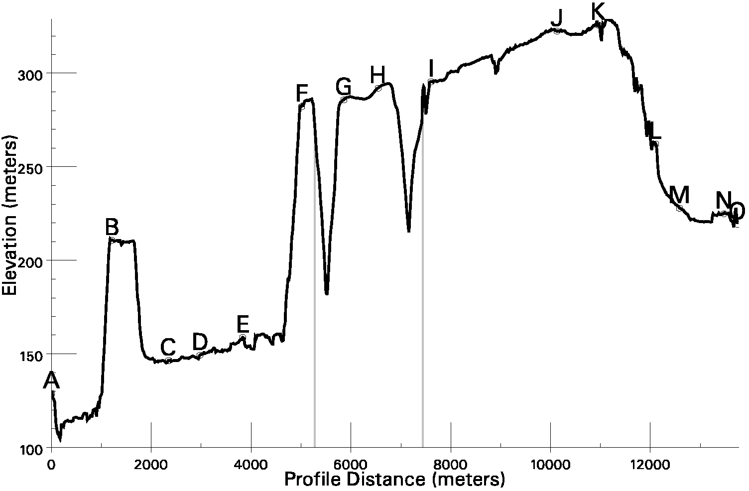
profilegraph.png
arcinfo data which unzips to a workspace
named skogeo, containing three grids:
- elv : the 10-meter DEM, Z in decimeters
- shade: shaded relief
- geogrid: the gridded DNR geologic map, distinguishing 31 different units.
This is a proprietary draft, and should not be redistributed.