We created two groups of swaths (each using 5 km swaths), one along
a single transect (A), and three along different transects (B). Both were
clipped to the deformation front. The procedure is given here.
The relation of these groups to the coastline and the topography is shown
here.
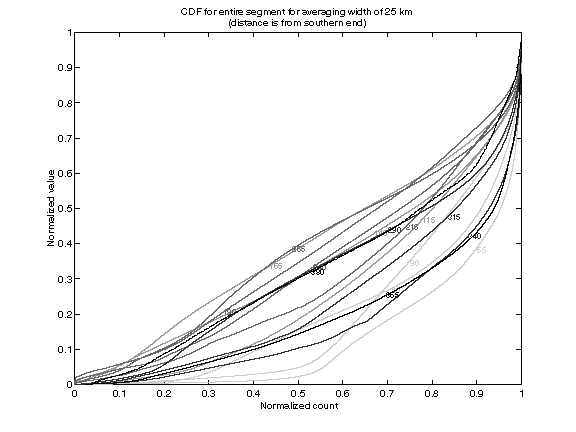
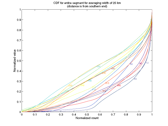
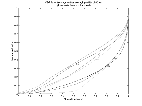
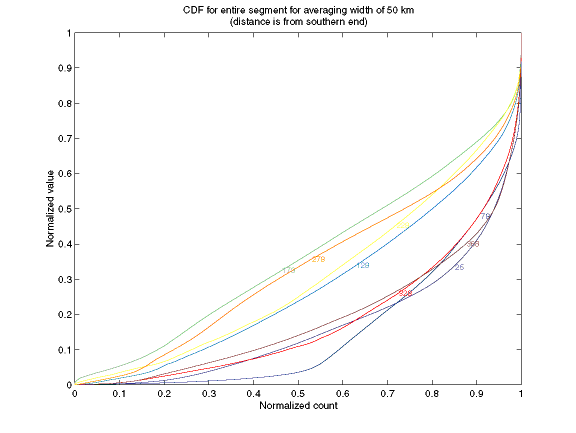
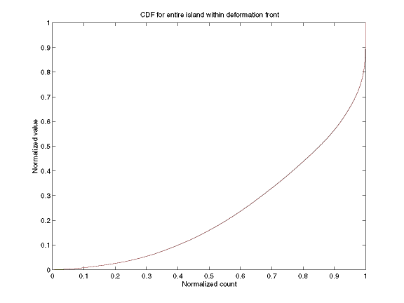
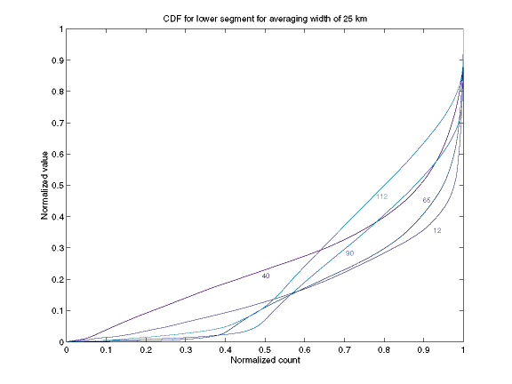
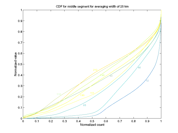
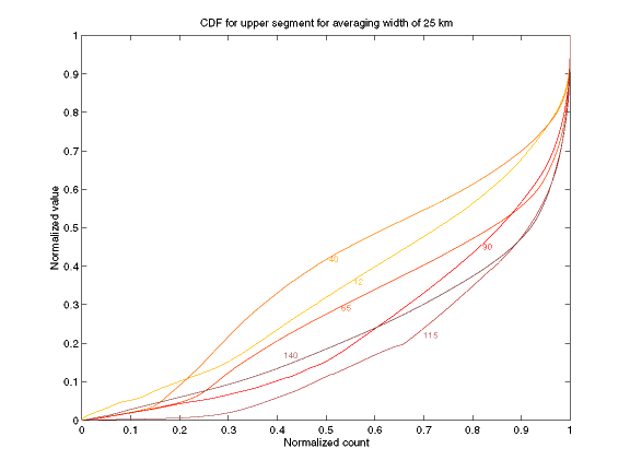
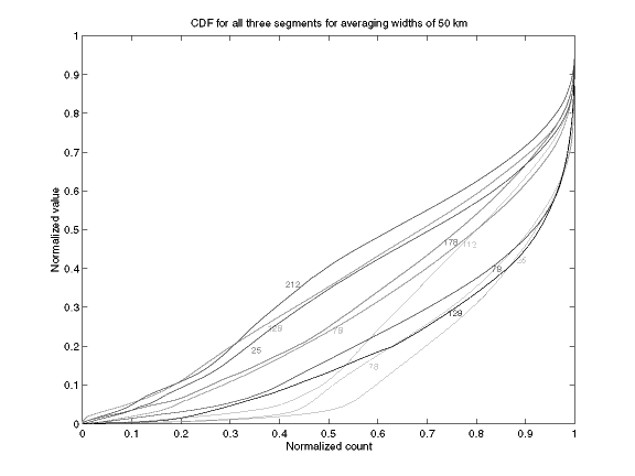
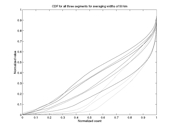
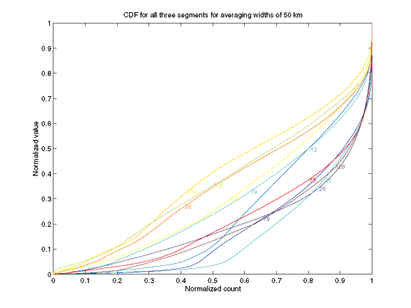
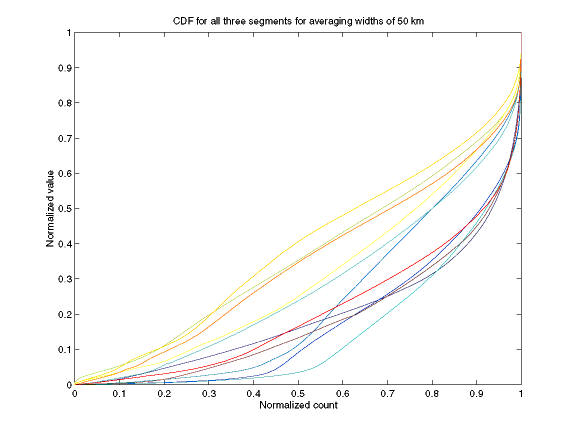
HypsometryTo keep the plots from being a complete mess, we averaged the swaths every 25 and 50 km. The hypsometric curves for groups (A) and (B) are given below. For group (A) the distances from the southern end of the island are plotted next to each line. For group (B) the distances from the southern end of each transect are plotted next to each line. The colors cycle from dark blue to red so curves from the south are generally plotted in shades of blues, curves from the "middle" are plotted in blues, greens, and yellows, and curves from the north are plotted in yellows, oranges, and reds.
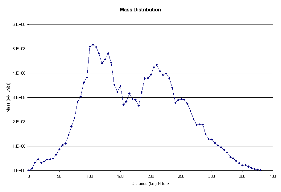
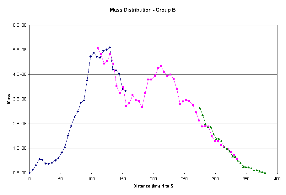
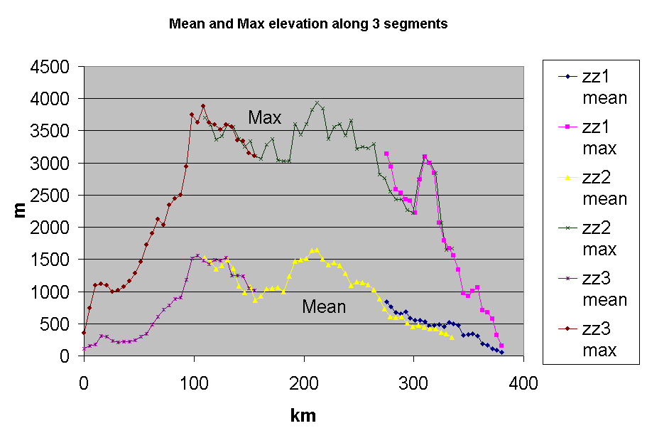
Mass Distribution/ Elevation StatisticsWe ran zonal stats on the new swaths (cut to deformation front and removing Coastal Range). The same groups apply (A - single line; B - three line segments with overlap) as before.Group (A) Mass Distribution
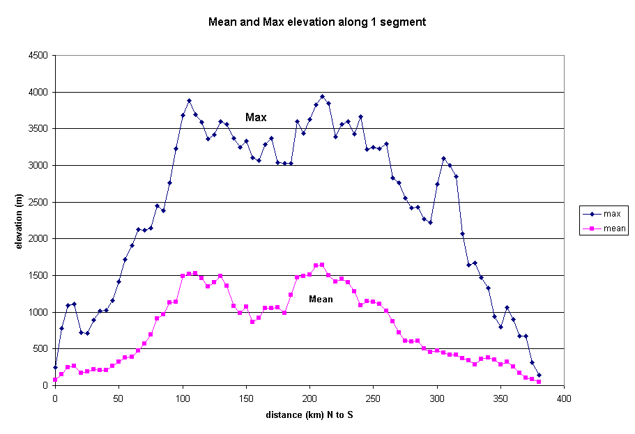
Group (A) Max/Mean Elevations
|
updated 5/14/1