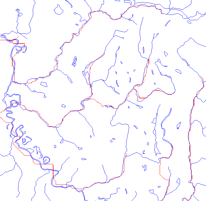
Compare the hydrography from the USGS 100K maps (blue) with the calculated rivers from ARC/INFO (red). The threshhold is not calibrated; that is not the issue. Note though that a river flows in the wrong direction.
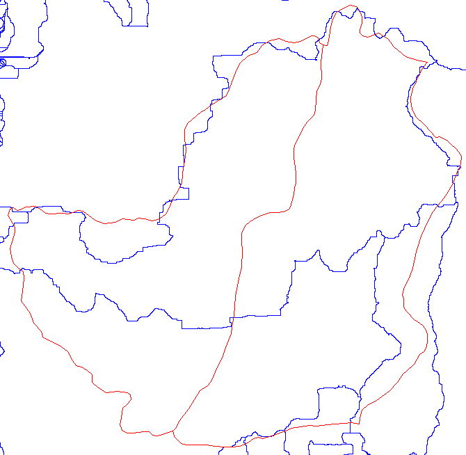
Compare the calculated basins to the cartographically produced basins.
We are not attempting here to use the contributing area of the streams, but we are interested in the contributing area of hillslope cells. Calculated ridgelines will be modeled as very stable areas, even if they are in the middle of hillslopes on the Weyerhaeser watershed polygons. Some ridglines (edge of the drawn basin boundary) will be modeled as damp (and less stable) ONLY IF the stability calculation is done before clipping to the polygon boundary.
Here are results for runs done on a rectangle, masked to the Weyerhaeuser boundary.