South_Side_McKenzie
The township codes are messed up, whcih makes me suspicous of the
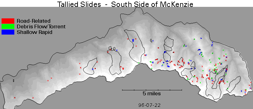
Landslide Map
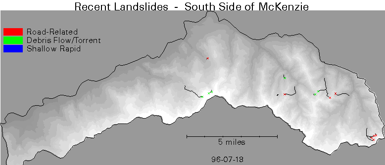
Recent Landslide Map
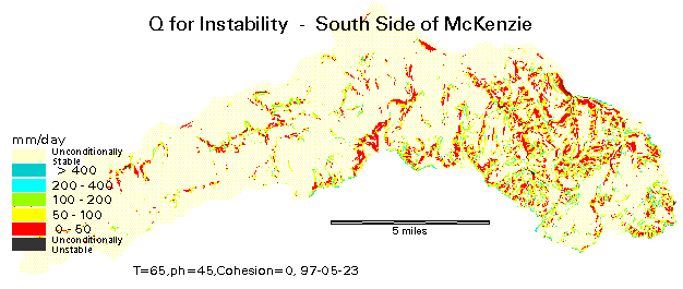
30' Mapped Stability at phi=45Ḟ, Coh=0 kN/mĠ
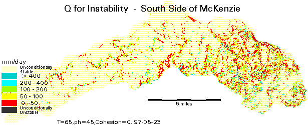
100' Mapped Stability at phi=45Ḟ, Coh=0 kN/mĠ
Here are 100-foot-cell results for
Here are 30-foot-cell results for
Note: The new flood data polygons are small circles, so the least stable cell
touching the polygon may be more stable than the least stable cell in a
linearly represented slide.
Here are 100-foot-cell results for NEW FLOOD DATA
Here are 30-foot-cell results for NEW FLOOD DATA