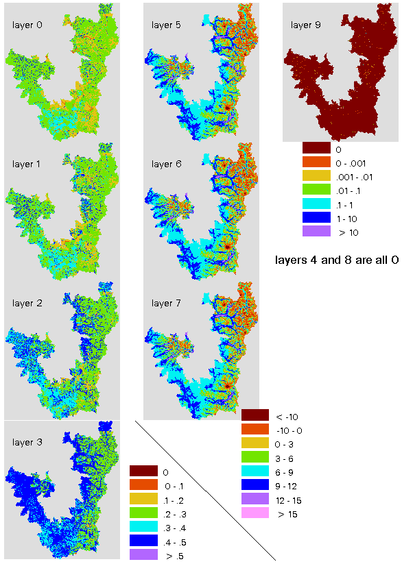
This is DHSVM output as of May 18, 2004. The Skokomish and Methow basins are not shown, as they need more work.
This is DHSVM output as of May 18, 2004. The Skokomish and Methow
basins are not shown, as they need more work.
0. Soil moisture as percent saturation,  layer 1
1. Soil moisture as percent saturation, layer 2
2. Soil moisture as percent saturation, layer 3
3. Soil moisture as percent saturation, deep layer
4. Soil surface temperature in ?C
5. Soil temperature in ?C. layer 1
6. Soil temperature in ?C. layer 2
7. Soil temperature in ?C. layer 3
8. Ground heat storage in J (float)
9. Surface ponding in m (float)
another basin boundary as a UTM NAD27 export file. These boundaries stop at the shoreline.
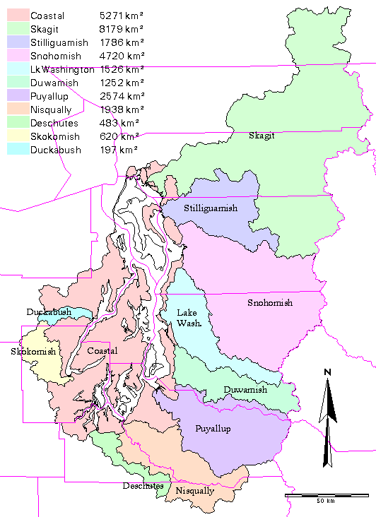
The major PRISM basins, showing gauges.
Note that the basins designated
"coastal", Stillaguamish, and Lake Washington are not gauged,
nor is the area below the eight gauges.
5/29/01: Thanks to Josh for pointing out that for a couple years the
table in the above map was off by a factor of 1000. You knew what I meant,
didn't you? The more you think about rivers, the smarter you are.
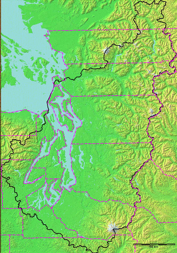
This image was built from a 30-meter DEM of the PRISM area.
We have elevations at 30-meter spacing, covering a rectangle of 10146 × 7083
points. This is much more detailed than the screen image.
The US data is public domain. The Canadian data is available only to
those who are covered under our license agreement with B.C. Glaciers were derived
from a Washington DNR data set, which is available in raw form only to the UW community.
Water bodies were derived from a combination of DNR data and the DEM.
We now also have the entire US portion at 10-meter resolution.
International PRISM grid resampled to 150-meters
Contact Harvey for full-resolution data.