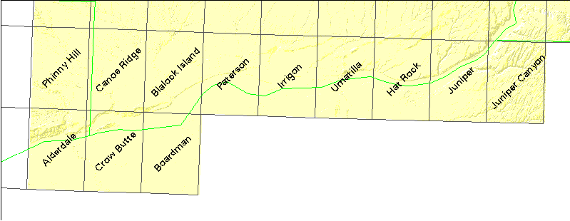
About this table
about clipping collars and new rectangles
about tfw files
documentation from the USGS CDROM
| USGS name | # quads | DNR# | name | file size |
|---|---|---|---|---|
| c45118a1 | 12 | - | (1°×2° quad) | 5078546 |
| z45118 | 1 | - | (Mosaicked 24K quads) | 2859643 |
| z45119 | 11 | - | (Mosaicked 24K quads) | 27117022 |
| o45119h8 | 1 | 2541 | Phinny Hill | 1825201 |
| o45119h7 | 1 | 2542 | Canoe Ridge | 1889045 |
| o45119h6 | 1 | 2543 | Blalock Island | 2890585 |
| o45119h5 | 1 | 2544 | Paterson | 2261853 |
| o45119h4 | 1 | 2545 | Irrigon | 2158567 |
| o45119h3 | 1 | 2546 | Umatilla | 2665127 |
| o45119h2 | 1 | 2547 | Hat Rock | 2361109 |
| o45119h1 | 1 | 2548 | Juniper | 2423865 |
| o45118h8 | 1 | 2549 | Juniper Canyon | 2859643 |
| o45119g8 | 1 | 2641 | Alderdale | 2708745 |
| o45119g7 | 1 | 2642 | Crow Butte | 2062647 |
| o45119g6 | 1 | 2643 | Boardman | 2345569 |