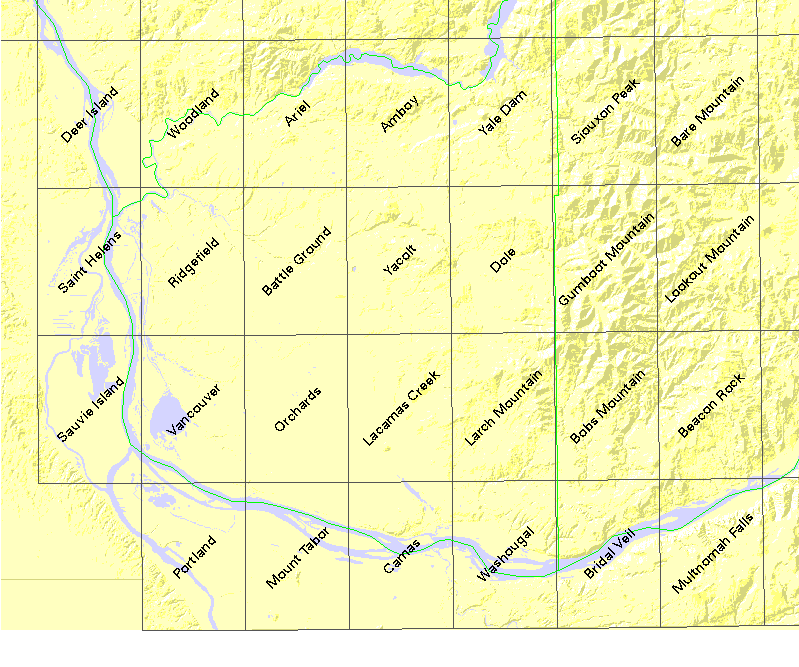
About this table
about clipping collars and new rectangles
about tfw files
documentation from the USGS CDROM
| USGS name | # quads | DNR# | name | file size |
|---|---|---|---|---|
| c45122a1 | 27 | - | (1��2� quad) | 6445562 |
| f45122e1 | 27 | - | VANCOUVER (NE quarter) | 6890509 |
| z45122 | 27 | - | (Mosaicked 24K quads) | 79447770 |
| o45122h7 | 1 | 2518 | Deer Island | 2791739 |
| o45122h6 | 1 | 2519 | Woodland | 3111719 |
| o45122h5 | 1 | 2520 | Ariel | 2995174 |
| o45122h4 | 1 | 2521 | Amboy | 3012278 |
| o45122h3 | 1 | 2522 | Yale Dam | 2397595 |
| o45122h2 | 1 | 2523 | Siouxon Peak | 3038713 |
| o45122h1 | 1 | 2524 | Bare Mountain | 2867731 |
| o45122g7 | 1 | 2618 | Saint Helens | 3310807 |
| o45122g6 | 1 | 2619 | Ridgefield | 3040431 |
| o45122g5 | 1 | 2620 | Battle Ground | 2505958 |
| o45122g4 | 1 | 2621 | Yacolt | 2527587 |
| o45122g3 | 1 | 2622 | Dole | 1730149 |
| o45122g2 | 1 | 2623 | Gumboot Mountain | 2931887 |
| o45122g1 | 1 | 2624 | Lookout Mountain | 2537979 |
| o45122f7 | 1 | 2718 | Sauvie Island | 2820190 |
| o45122f6 | 1 | 2719 | Vancouver | 3971705 |
| o45122f5 | 1 | 2720 | Orchards | 2990027 |
| o45122f4 | 1 | 2721 | Lacamas Creek | 2107944 |
| o45122f3 | 1 | 2722 | Larch Mountain | 2145268 |
| o45122f2 | 1 | 2723 | Bobs Mountain | 2546759 |
| o45122f1 | 1 | 2724 | Beacon Rock | 2667230 |
| o45122e6 | 1 | 2819 | Portland | 4777591 |
| o45122e5 | 1 | 2820 | Mount Tabor | 4564457 |
| o45122e4 | 1 | 2821 | Camas | 4114571 |
| o45122e3 | 1 | 2822 | Washougal | 3384473 |
| o45122e2 | 1 | 2823 | Bridal Veil | 2681107 |
| o45122e1 | 1 | 2824 | Multnomah Falls | 2702668 |