Landsat Scenes for Western Washington State
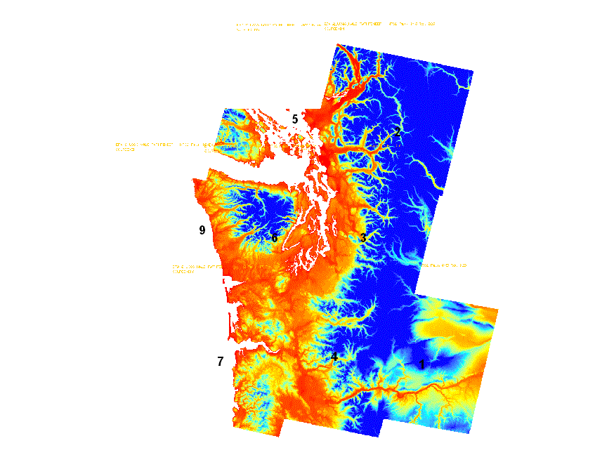
This is the data from nine 8mm tapes at the University of Washington Map Collection,
call# G4281.A43.1990.E7. Directories 1-7 and 9 each contain a DEM and four
5-band or 6-band scenes. They are in UTM 10, NAD27. Pixel size is 60 meters.
Tape/directory 8 contains a mosaic of Puget Sound and Georgia Strait.
Coordinates for this one are in seconds.
The .txt files in each directory provide more information.
See also USGS
. Users of the data
are welcome to contribute to this page.
It would also be good to be reassured that posting this page was worth it.
NALC tape 1
NALC tape 2
NALC tape 3
NALC tape 4
NALC tape 5
NALC tape 6
NALC tape 7
NALC tape 8
NALC tape 9
The web directories differ from the tapes in that:
- Files on tape have no names, so names were adapted from
NALC_README.txt
- Each .bsq (band sequential: like bil, but grouped by band) file
has been zipped for ~5:1 compression.
- A script created the hdr files.
- Due to media errors, the last scene on tape 9 was not read.
- DEMs (and some images) have aux and rrd files because they were
viewed in ArcMap.
Note: The README suggested block sizes for reading from tape.
These did not work for me; I needed to use 32768 for all files.
Questions to Harvey Greenberg or
WAGDA