Mount Saint Helens DEMs
I located the
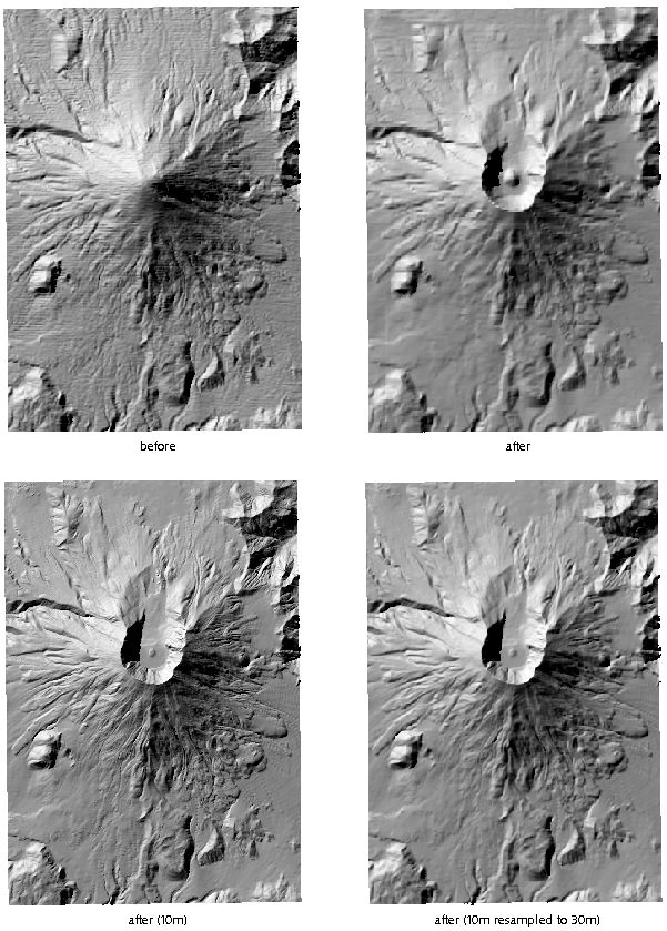
pre-eruption 30-meter Saint Helens quadrangle
DEM. The shaded-relief image derived from it shows it to be a level-1 DEM
with many east-west artifacts. The
new DEM is a level2 product. I also have the
10-meter DEM (with vertical units in feet.) The lower right quarter
of the image above shows the
thirtymeter DEM mosaicked and updated by resampling the 10-meter data.
As young people do not remember the USGS DEM format instituted by
Thomas Jefferson (or maybe it was a little bit later),
I have converted the DEMs to
tif files. They are UMT10-NAD27.
Other quadrangles were updated to show mudflows from Mount Saint Helens.
I do not have the pre-eruption 30m versions of those areas, but
the USGS has a
new pre-eruption 10-meter DEM! (or get it here)