 No, there's not much to see. We have converted this strip
of Seattle to VRML for the Human Interface Technology Lab.
No, there's not much to see. We have converted this strip
of Seattle to VRML for the Human Interface Technology Lab.
No, there's not much to see. We have converted this strip
of Seattle to VRML for the Human Interface Technology Lab.

This is the landscape with 10803 triangles draped on it. The picture is based on 30-meter DEMs, but the TIN is built from 10-meter DEMs.
4928 triangles
10803 triangles
These are is UTM zone 10 NAD27. Nick, do you have the
DOQQs you need? Do you have the headers that render them
in NAD27?
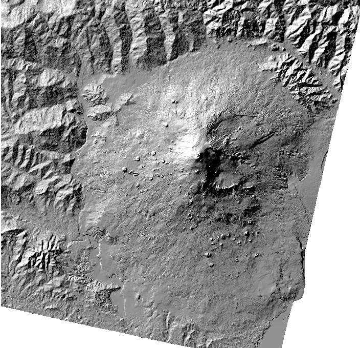
 This is a grossly simplified
Mount Rainier. I had ARC/INFO create a TIN and convert it
to a vrml file. I then used my own
VRML to STL translator to create this
stl (stereo lithography language) file. If you can
e it okay, James, I will make big files. This is in units
of world meters, is that okay?
Here's a big Mount Rainier stl file.
It has 510815 triangles and unzips to 84,812,319 bytes.
The maximum vertical deviation from the USGS 10-meter DEM
is 10 meters. The model covers a generous rectangle
(569655E,5166785N to 613195E,5222705N in UTM NAD27) around
Mount Rainier. It is translated to a center at (591425,5194745,2264.75).
Let me know, James and Jeff, if there is any problem with map extent,
file size, or the lack of vertical exaggeration.
This is a grossly simplified
Mount Rainier. I had ARC/INFO create a TIN and convert it
to a vrml file. I then used my own
VRML to STL translator to create this
stl (stereo lithography language) file. If you can
e it okay, James, I will make big files. This is in units
of world meters, is that okay?
Here's a big Mount Rainier stl file.
It has 510815 triangles and unzips to 84,812,319 bytes.
The maximum vertical deviation from the USGS 10-meter DEM
is 10 meters. The model covers a generous rectangle
(569655E,5166785N to 613195E,5222705N in UTM NAD27) around
Mount Rainier. It is translated to a center at (591425,5194745,2264.75).
Let me know, James and Jeff, if there is any problem with map extent,
file size, or the lack of vertical exaggeration.
Wait, here's another Mount Rainier, clipped more tightly (581395E,5177085N to 606875E,5205545N) with a maximum deviation of 5 meters. It unzips to only 78,988,733 bytes. Note that my stl files are surfaces; they have no bottoms. Is this a problem?
and this is Mount Etna