Very Rough Draft
In the past, we have been reasonably happy making water flow downhill
on grid-based DEMs. Sinks have been troublesome, but programs like proffix2.aml
and agree have mitigated this problem.
LIDAR presents more problems
LIDAR begins as a TIN. Conversion to a grid involves a tradeoff between
file size and data loss. Once a TIN becomes a grid, translation to other
coordinate systems costs information.
LIDAR will show valid sinks, and it will portray situations where culverts and
underpasses are part of the hydrology.
I propose that we try working with TINs.
ARC/INFO allows us to convert a TIN to a coverage, calculating many
important items along the way.
Establishing flow in such a coverage is not difficult, particularly with
java tools.
If the ASCII point data is converted to a TIN via an intermediate point coverage,
the TIN will retain information about the original points.
Culverts and underpasses could be added to the coverage without affecting to
integrity of the original data. Pseudo-culverts could be added to drain any
remaining sink to the nearest lower node (or obey a more complex criterion.
Some of this will involve fresh work, though some ideas have been testing in
displaying output of
the CASCADE model
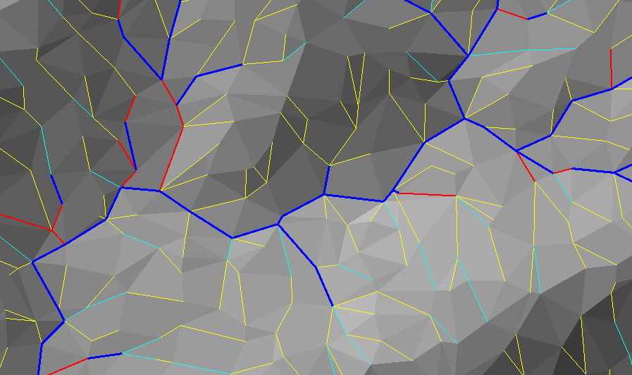
This image shows a portion of a TIN created by CASCADE (run8b) with streams (edges with a
contributing area > 10 square kilometers) and channels (any edge with concave cross section).
Blue lines are streams with legal cross sections.
Red lines are illegal streams; they don't hold water.
Cyan lines are small legal flow paths.
Yellow lines are illegal small flow paths.
33% of all edges are CASCADE flow paths; they represent the steepest path of
descent from one node to another.
Only 9% of all edges have proper channel geometry.
I will be interested in seeing these numbers for a LIDAR-based TIN.
I am trying to convert the CASCADE TIN to a 100-meter grid, and compare
the results to the TIN-based analysis. The first complication is the
algorithm used to create the grid. If I use a linear interpolation, I
get a surface on which all the curvature is concentrated at the
location of the TIN edges. If I use a quintic interpolation
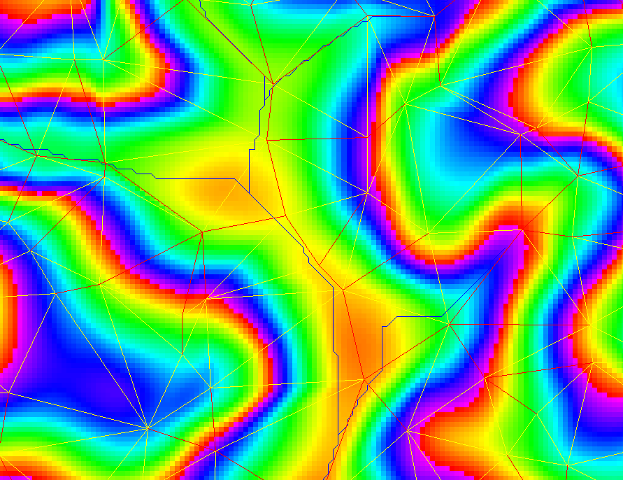
I get concavities. The image above shows the
TIN (yellow), CASCADE flows lines (red), and calculated streams derived from
the filled quintic-based grid (blue), laid over the quintic-based DEM
(rainbow shades). As the CASCADE TINs do not have concavities, they are
only a few minor sink artifacts to repair. The sinks in the quintic
surfaces pose harder questions. One option would be to take the maximum of
the linear and quintic surfaces. This would preserve convexities, but would
flatten out the convergent concavities. Instead, we simply fill the sinks,
preserving the upper parts of the concavities.
Now let's compare the results for 5 methodologies:
- The edges of the TINs, using CASCADE areas and slopes. (all main basin streams)
- Calculated streams, based of the flat grid. (all main basin streams)
- Calculated streams, based of the quintic grid. (all main basin streams)
- 100-meter cells, based of the flat grid and mainstem profiles.
- 100-meter cells, based of the quintic grid and mainstem profiles.
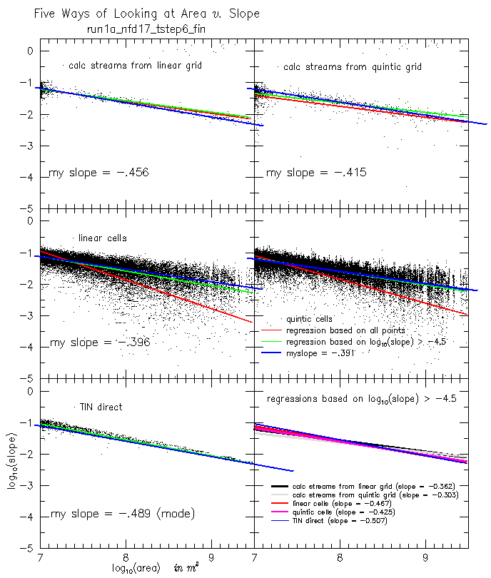
The red lines show the regression on all data points in log-log space.
Low slopes (flat spots are arbitrarily defined as log(slope)=-5) skew
the regression line. The green regression line (eliminating log(slope) < -4.5)
gives a better looking fit. Perhaps we should throw out for outlyers.
Or maybe I should eyeball the regressions (blue lines).
Note that earlier CASCADE reports looked only at the mainstem (one
basin at a time), so points were denser to the right side of the graph.
These graphs show all streams (area > 10km) for the major basins (and
consolidate them in one graph), so points are denser toward the left
side of the graphs.
Note that we follow the CASCADE convention of associating node data with
the downstream arc.
Now let's look at harvey1 and harvey2
As Drew did not supply discharge data--and it would take some effort to
generate discharge from the TIN--I am using streamorder as a surrogate for
discharge. Of the 19700 edges defined by the donors file (all the edges
shown), only 8968 are concave channels. If we eliminate the dangling
edges (as seen in black), the results are better. Of 8525 remaining edges,
6429 (green) edges are concave channels. The bad 25% are shown in red.
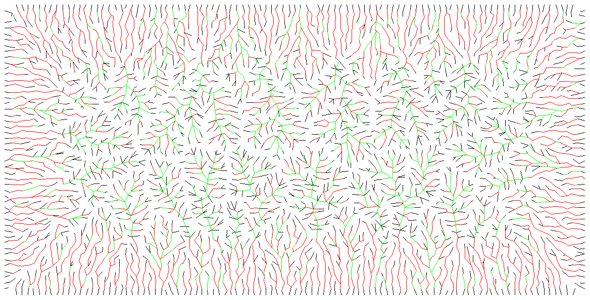
This is harvey2. Only 1195 (25%) of 4851 non-dangling edges are concave.
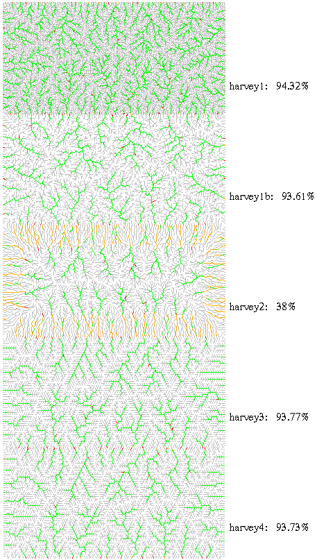
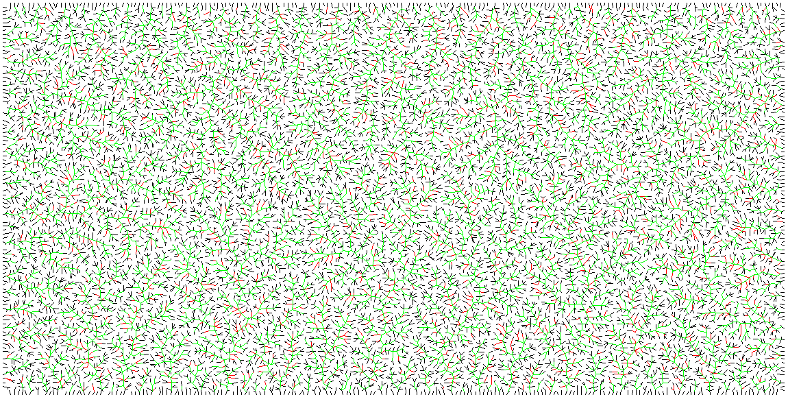
These are 5 runs from Drew. He can explain the details. Gray lines are
the flowpaths of area < 0.1. Green lines are well-behaved streams.
Orange lines are slightly misbehaved streams, and red lines are bad streams.
The percentage of well-behaved streams is shown. Note that much of the
bad behavior is on the outlet segment.
Hands-on LIDAR work