|
|
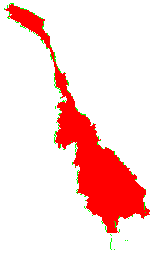
The red shows the Mekong drainage as calculated from the SRTM DEM. The green is the basin boundary used by Mariza for the VIC model. I did not go to the trouble of defining the delta area properly. The manner in which I used 30" data to fill voids in SRTM created a DEM with large bogus "sinks" in the river channel. These leave the channel position uncertain in a 2-km wide strip, but do not substantially affect the calculated drainage network. |
|
| |
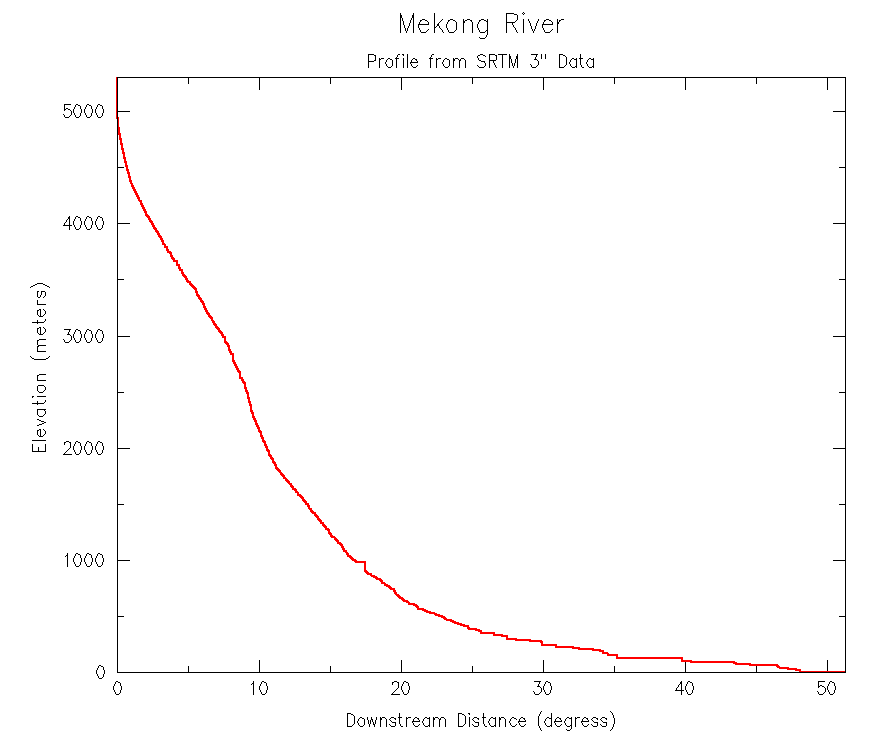
| This profile was calculated from the SRTM DEM. The problem areas arise from places where voids were filled with data from the 30" DEM. The profile was traced downhill from cell to cell. The algorithm follows topography into "sinks", and then does its best to reach the pour point in an orderly manner. Elevations are interpolated between a "sink" bottom and the first downstream cell to have a lower elevation. | |
New station data 2000/10/1-2004/4/4
Questions:
Harvey Greenberg