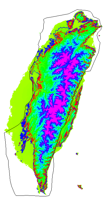
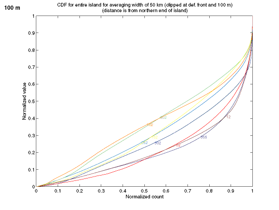
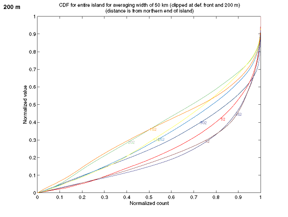
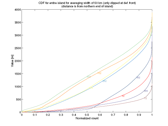
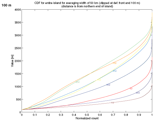
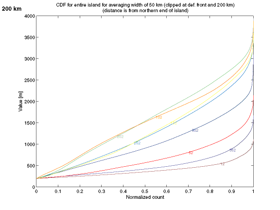
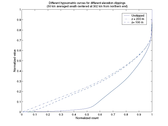
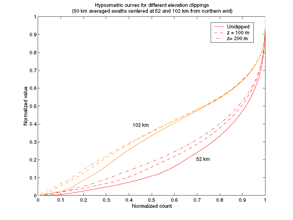
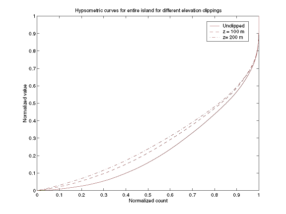
HypsometrySwathsWe're now using the group of swaths from the single transect for all future calculations. The swaths have been clipped to the deformation front (see group (A) here). Also, the hypsometric curves have been calculated by excluding points below 100 and 200 meters. The relation of these contours (blue for 100 m, red for 200 m, and black for the deformation front) is shown here.
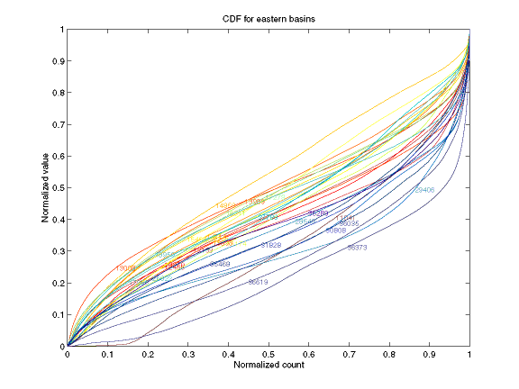
BasinsWe used the bigdefbasins grid to get the hypsometry for each basin. We ordered the basins on the eastern side from south to north for plotting purposes (south = blue, north = red).Here are the curves for 28 eastern basins (outlined here).
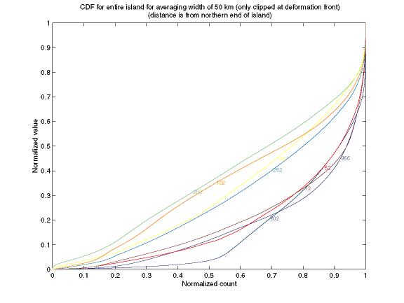
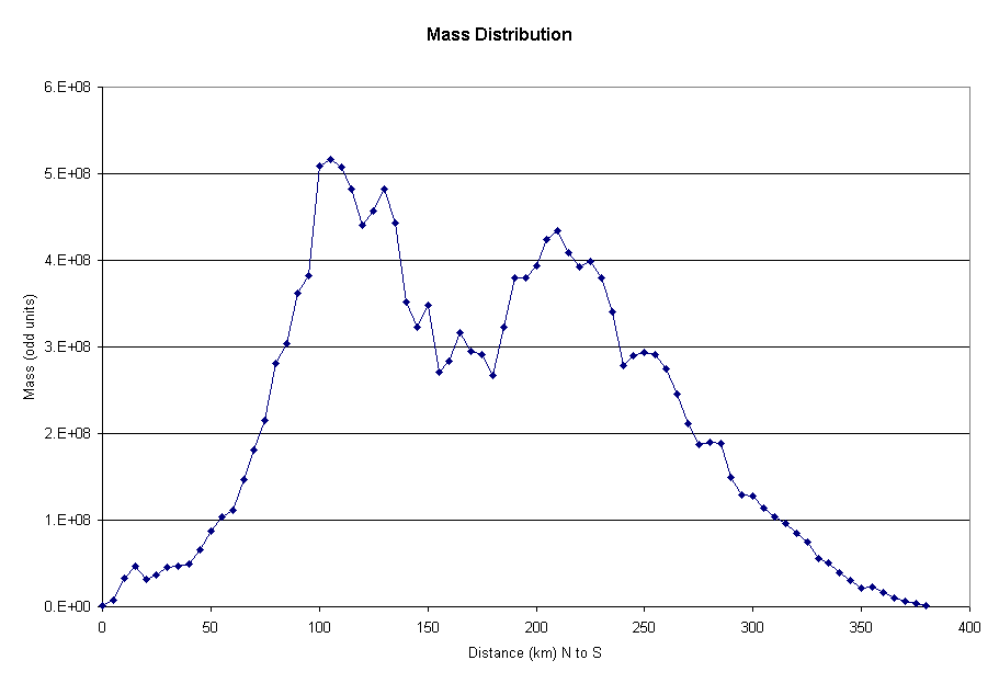
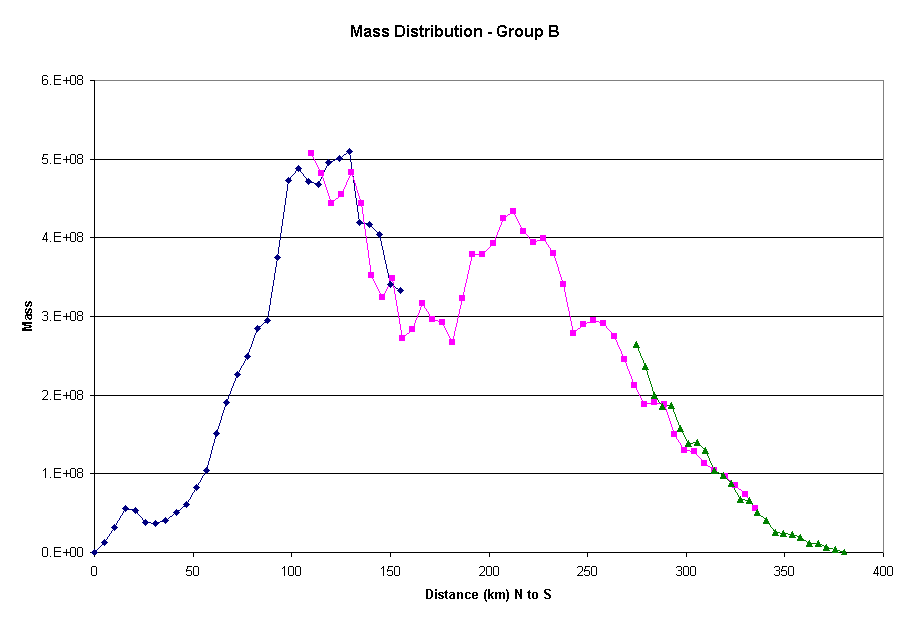
Mass Distribution/ Elevation StatisticsWe ran zonal stats on the new swaths (cut to deformation front and removing Coastal Range). The same groups apply (A - single line; B - three line segments with overlap) as before.Group (A) Mass Distribution
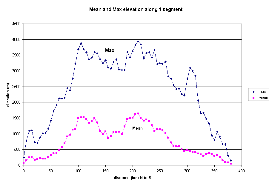
Group (A) Max/Mean Elevations
|
updated 5/16/1