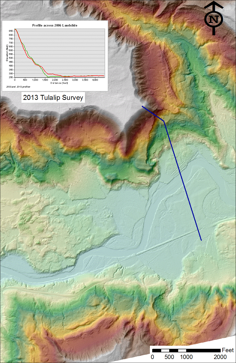
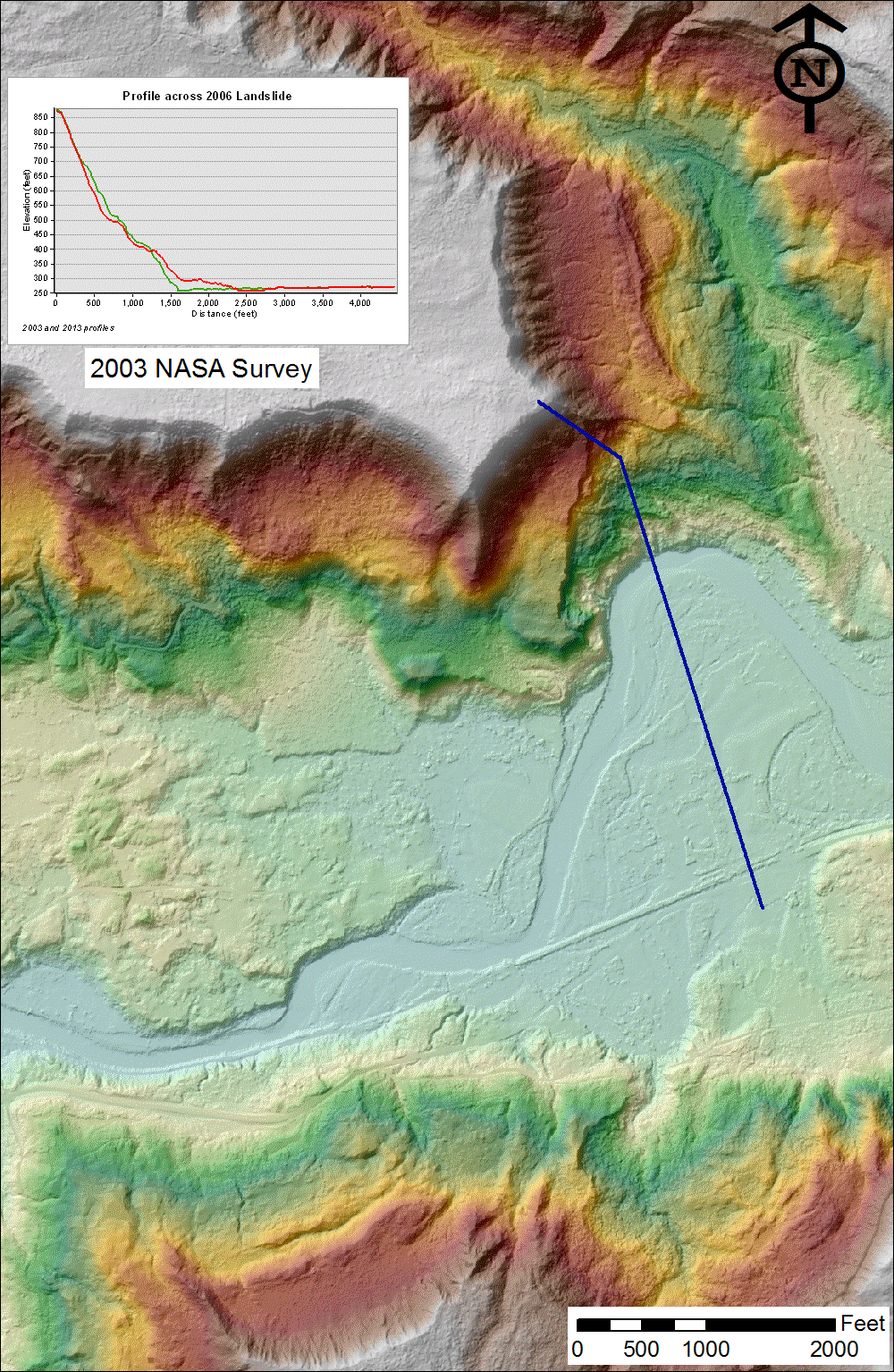
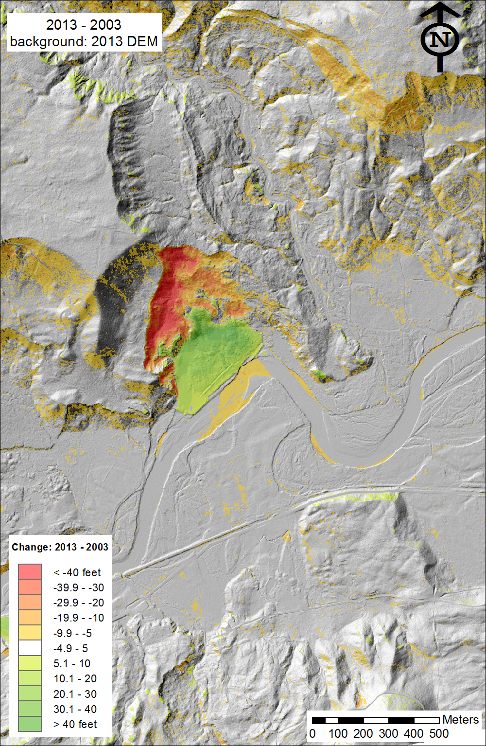
This page incorporates the 2003 and 2013 LiDAR surveys,
showing the results of the landslide of 2006.
Newer maps:Maps with 2014 DOT data
 (3-foot cell size)
 (6-foot cell size)
For those with GIS who have trouble with filegeodatabase (.gdb) files, we have posted geotiff files of a limited area. The the shaded-relief (grayscale topographic image) can be seen in any picture viewer, and will land in the right place in any GIS program. The elevation file is similar, but its 16-bit data will be a problem in some image viewers. The original data is floating point numbers, but it has been scaled to integer inches (be careful) for portability. The actual color picture is not a geotiff, but is almost a pixel-for-pixel match to the others.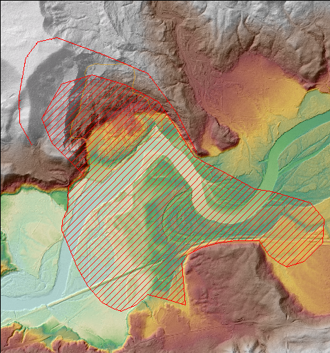
2013 topography, showing 2006 and 2014 landslides. (11MB)
shaded2013.tif (3MB)
elevation2013inch.tif (4.4MB)
More geotiff files of the Darrington (2003) and Tulalip (2013) surveys are available by the quarter-quad (3.75 arc-minutes ~= 2 by 3 miles) at the the Puget Sound LiDAR Consortium and NASA.
(3-foot cell size) (6-foot cell size)For those with GIS who have trouble with filegeodatabase (.gdb) files, we have posted geotiff files of a limited area. The the shaded-relief (grayscale topographic image) can be seen in any picture viewer, and will land in the right place in any GIS program. The elevation file is similar, but its 16-bit data will be a problem in some image viewers. The original data is floating point numbers, but it has been scaled to integer inches (be careful) for portability. The actual color picture is not a geotiff, but is almost a pixel-for-pixel match to the others.
2013 topography, showing 2006 and 2014 landslides. (11MB)
shaded2013.tif (3MB)
elevation2013inch.tif (4.4MB)
More geotiff files of the Darrington (2003) and Tulalip (2013) surveys are available by the quarter-quad (3.75 arc-minutes ~= 2 by 3 miles) at the the Puget Sound LiDAR Consortium and NASA.
See also
earthobservatory.nasa.gov for 2014 photos
PSLC for lidar (if you register), and
USGS for geomorphology/data.
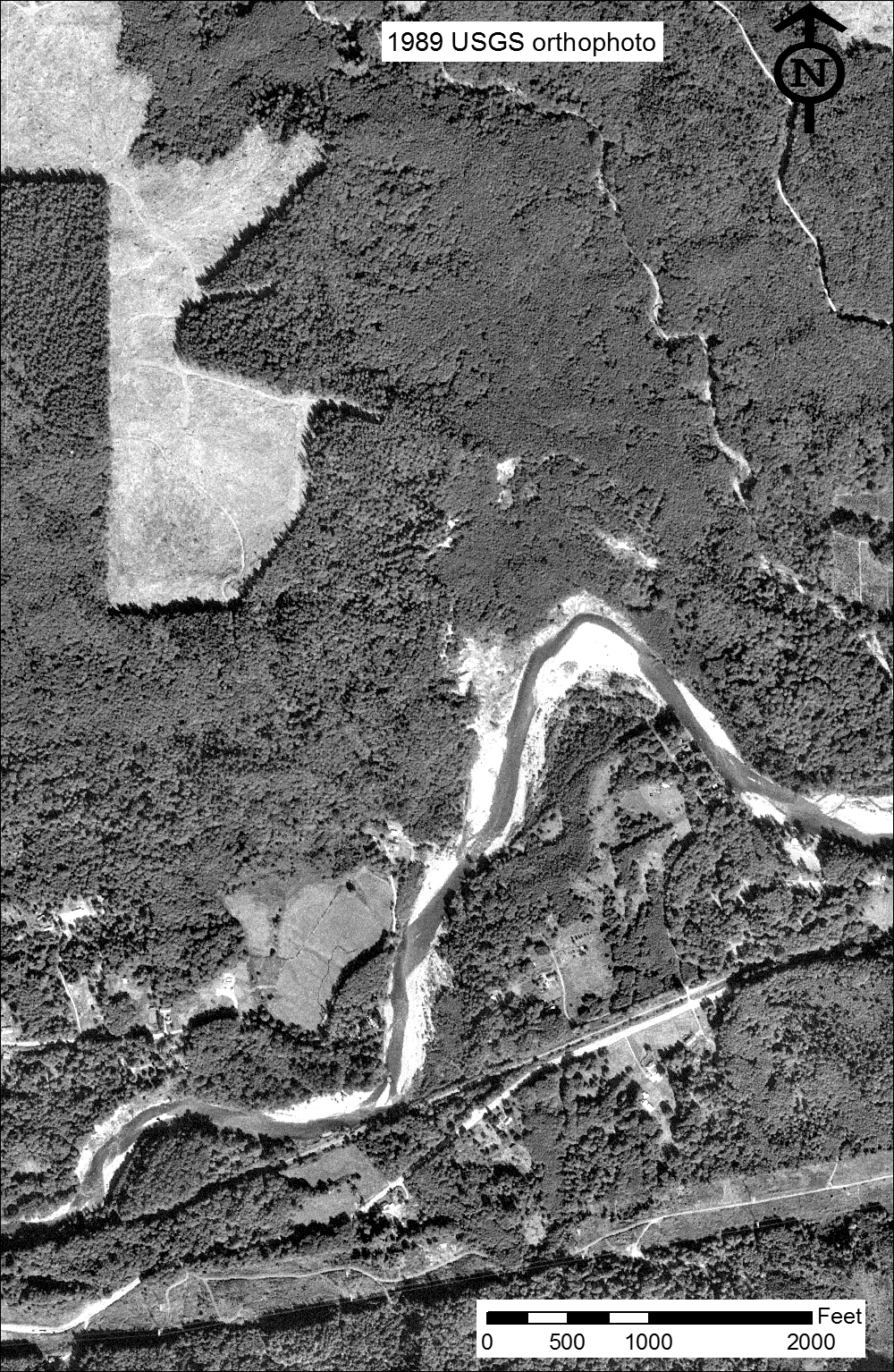
Images by Harvey Greenberg
Department of Earth & Space Sciences
University of Washington
Data from
Tulalip Tribes (2013)
NASA (2003)
through the
Puget Sound LiDAR Consortium
NAIP photo from USDA
1983 photo from USGS
March 25-28, 2014