| Name | Last modified | Size | Description | |
|---|---|---|---|---|
| Parent Directory | - | |||
| vic_detail.png | 2015-03-06 18:05 | 37K | ||
| vic_7basins_detail.png | 2015-03-24 15:23 | 19K | ||
| vic_7basins_detail.pgw | 2015-03-24 15:23 | 117 | ||
| vic_7basins.png | 2015-03-24 15:15 | 9.7K | ||
| vic_7basins.pgw | 2015-03-24 15:15 | 117 | ||
| vic2015.png | 2015-04-21 18:17 | 690K | ||
| vic2015.pgw | 2015-04-21 18:17 | 117 | ||
| vic.png | 2015-03-06 18:07 | 31K | ||
| soilpts.csv | 2015-05-06 11:35 | 47M | ||
| shedpolies.zip | 2003-09-29 15:31 | 4.5M | ||
| mask.zip | 2015-03-12 16:31 | 1.2K | ||
| basins.gif | 2003-07-30 14:36 | 190K | ||
| VIC/ | 2017-04-13 12:20 | - | ||
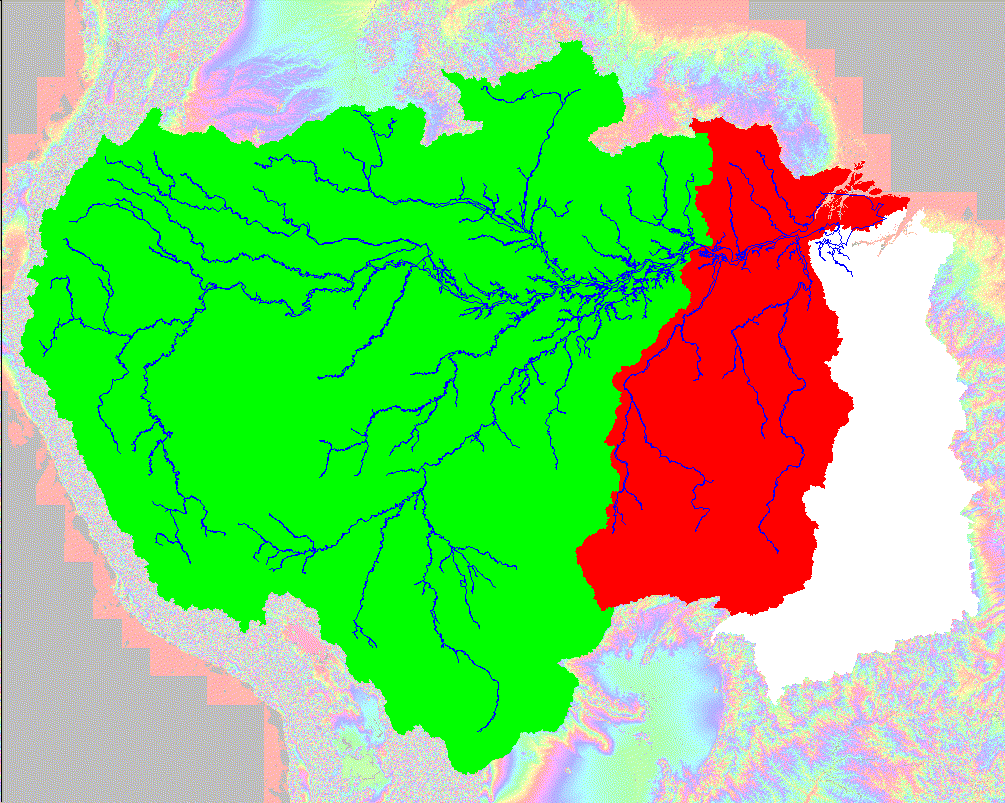
[This is based on the preliminary 3-second DEM. Publication has been on hold since September, 2003 because Rolf would like to use other means of checking the boundary where the DEM disagrees with other maps.]
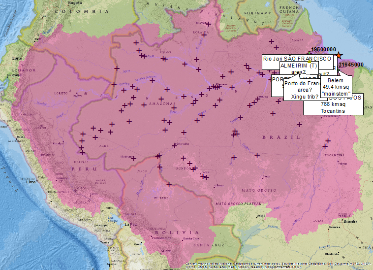
There are various ways to define the basin. The full tri-colored basin includes the southern nagivation channel, the city of Belťm, and the Tocantins River. This basin has an area of 6,903,034 square kilometers.
A more popular definition of the basin (red plus green) has an area of 5,973,851 square kilometers.
A third definition would be the area upstream of the city of ”bidos, the highest point of tidal influence. It has an area of 4,692,200 square kilometers.